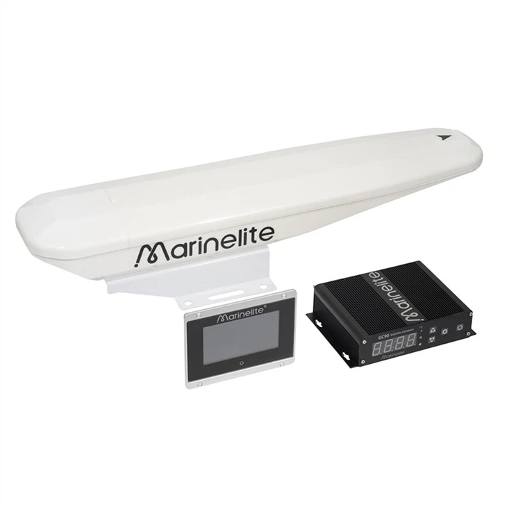
The Marine Digital Compass is a reliable heading and orientation sensor designed for marine navigation, offering accurate digital heading data independent of magnetic fluctuations. Powered by advanced GNSS‑based satellite technology, it delivers stable, real‑time heading, position, roll, and pitch information for all ship types.
With easy installation and optional NMEA 2000 connectivity, this digital compass enhances onboard navigation systems and supports safer, more efficient maneuvering at sea.
The Marine Digital Compass is an advanced maritime heading sensor that determines vessel orientation using satellite carrier frequency signals rather than traditional magnetic sensing. This method eliminates errors caused by the ship’s speed, latitude, geomagnetic disturbances and nearby metallic structures, providing more reliable and consistent heading information.
Equipped with GNSS technology, the compass outputs precise heading, position, roll, and pitch data in real time. With up to 0.4° heading accuracy and support for NMEA 2000 connectivity (optional), it seamlessly integrates into modern marine navigation networks, allowing bridge systems such as radar, chartplotters, autopilots, and ECDIS to receive highly stable orientation data.
This digital compass supports continuous tracking even during brief GNSS outages, maintaining correct heading for up to several minutes without satellite signal — a crucial feature for navigation reliability in challenging conditions. It also offers fast positioning and dynamic performance up to 90°/s, making it suitable for high‑speed operations.
Designed for marine environments, the sensor is rugged, easy to install, and compatible with a variety of vessel types, from commercial ships and workboats to yachts and patrol vessels. The digital design ensures minimal maintenance while providing consistent heading performance across navigation tasks.